Day1
Arrive in Kathmandu
Arrival at Tribhuvan International Airport. Transfer to your hotel in the Thamel district. Evening briefing with your guide and final equipment check. Overnight: Kathmandu.
A pioneering-era journey around the world's 8th highest peak. Tibetan villages, glacial lakes, and the crossing of Larkya La at 5,167 m.
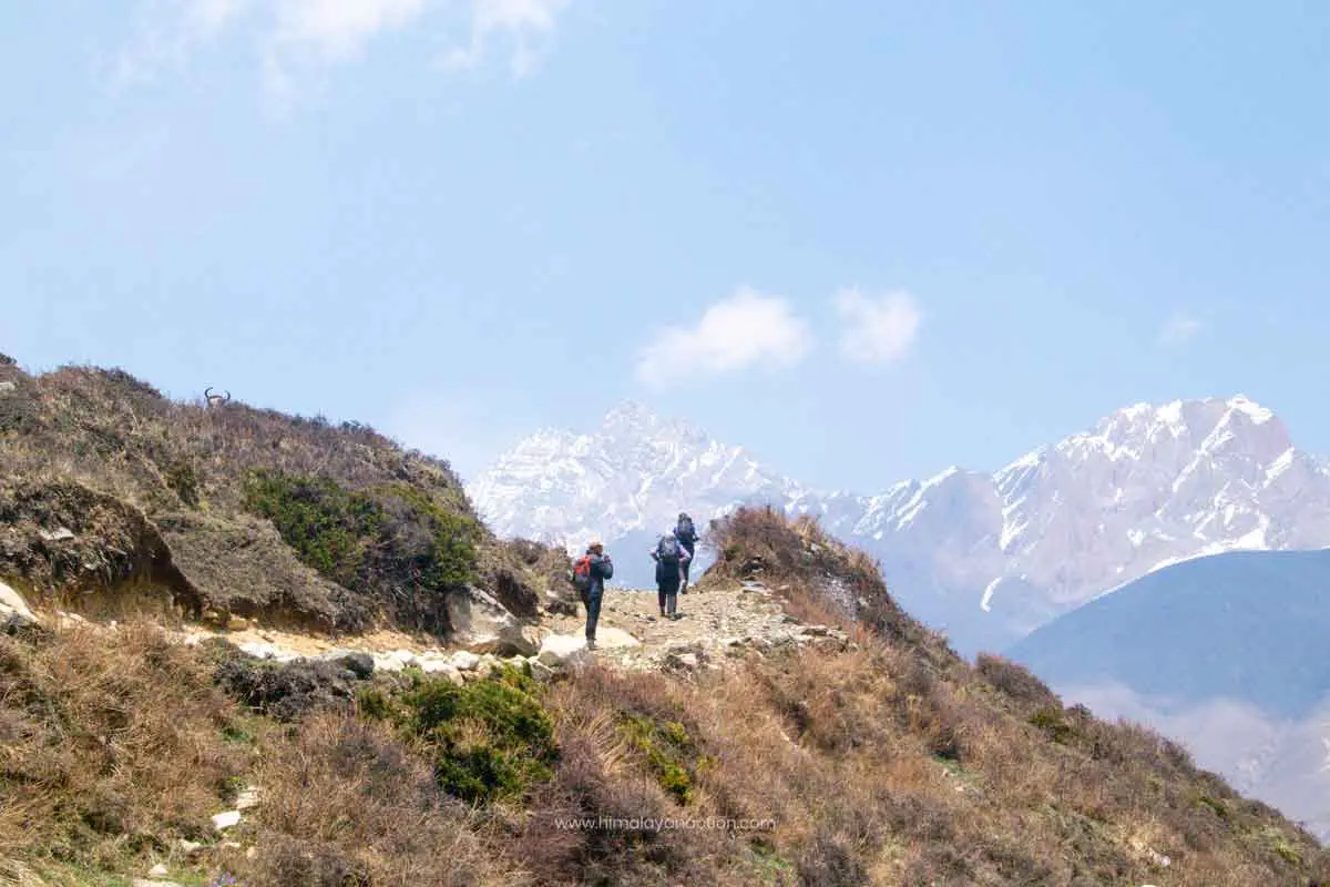
The Manaslu Circuit is Nepal at its most uncompromising. You walk for days without encountering another trekker, through Tibetan-influenced villages where stone houses, mani walls, and prayer flags define the landscape. The mountain itself, 8,163 metres of snow and ice, dominates every horizon from Shyala to Samagaon, growing larger and more overwhelming with each day of approach.
This is not a sightseeing itinerary. It is a physical and cultural immersion into one of the last genuinely remote major treks in the Himalaya.
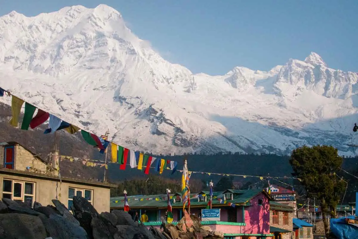
The world's 8th highest peak dominates the skyline throughout, especially dramatic from Shyala and Samagaon where the summit appears close enough to touch.
The trek's crowning moment: a pre-dawn ascent across icy terrain to a pass with panoramic views of Manaslu, Annapurna II, Himlung Himal, and Kang Guru.
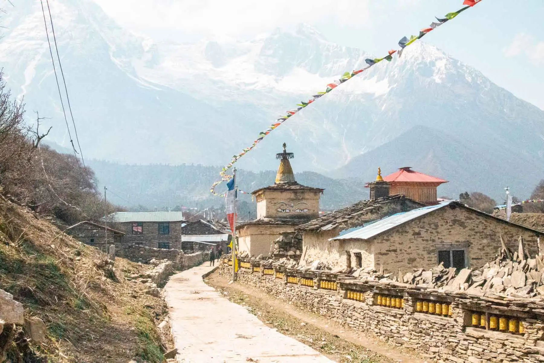
Samagaon and Samdo are home to the Nubri people, with Tibetan Buddhist culture expressed in stone houses, chortens, mani walls, and genuine hospitality.
A turquoise glacial lake at the foot of the Manaslu Glacier, its surface reflecting surrounding ice formations in crystalline stillness.
Far less traffic than Everest or Annapurna. The trail feels like pioneering-era trekking: raw, untamed, and profoundly quiet.
From steamy subtropical gorges of the Budi Gandaki River to rhododendron forests, high alpine meadows, and glaciers near the pass.
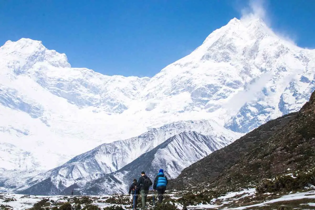
The full 16-day Himalayan Action route through the Nubri and Tsum valleys, with full acclimatisation and cultural immersion.
Arrival at Tribhuvan International Airport. Transfer to your hotel in the Thamel district. Evening briefing with your guide and final equipment check. Overnight: Kathmandu.
A morning of cultural orientation. Visit Swayambhunath (the Monkey Temple), Pashupatinath, and Boudhanath Stupa. Final permit arrangements and gear preparation. Overnight: Kathmandu.
Long but scenic drive through Nepal's countryside via Prithvi Highway to the riverside settlement of Machha Khola on the Budi Gandaki River. Overnight at a teahouse.
Trek ~8 hrs · 21.8 km. The trail winds along the Budi Gandaki through Gurung villages and subtropical forest past langurs, hot springs at Tatopani, waterfalls, and suspension bridges. Jagat is the first permit checkpoint and gateway into the restricted area.
Trek ~8 hrs · 23.5 km. Through rhododendron and pine forest past gompas, prayer flags, and Buddhist villages. Cross the Siyar Khola bridge at the Tsum Valley junction and continue to the remote village of Deng, nestled in a gorge surrounded by Tibetan-origin communities.
Trek 7–8 hrs · 20 km. Climb through bamboo and rhododendron forest past Rana and Bihi Phedi. The trail grows wilder, crossing landslide zones before zigzagging up to Namrung, a cultural hub at the threshold of the high-altitude Manaslu zone.
Trek ~6 hrs · 10 km. As the trail climbs, the landscape opens into a Himalayan amphitheatre. First full views of Manaslu (8,163 m), Himal Chuli, Ngadi Chuli, Ganesh Himal, Baudha Himal, and Shiringi Himal.
Trek 3–4 hrs · 9 km. Gentle walk through pine and rhododendron forest with Manaslu constantly overhead. Samagaon is the largest village in the Nubri region, home to a large gompa, helipad, health post, and Wi-Fi. Time to explore yak pastures and the village.
Hike to ~4,400 m · 7 hrs · 11 km round trip. Three options: Manaslu Base Camp (4,800 m) past the glacier for close-up views; the turquoise Birendra Tal glacial lake; or Pungyen Gompa monastery on the hillside above the valley. Return to Samagaon.
Trek 2–3 hrs · 5.7 km. Short but high-altitude day through yak pastures and mani walls. Samdo is a remote Tibetan-style village near the Tibetan border, the last major settlement before Larkya La.
Day trip to ~5,000 m · 8 hrs · 12 km round trip. Hike toward the Tibetan border for altitude acclimatization. Views stretch into Tibet and Nepal. Spot yak caravans, Blue Sheep, Marmots, and Pika near the glacier.
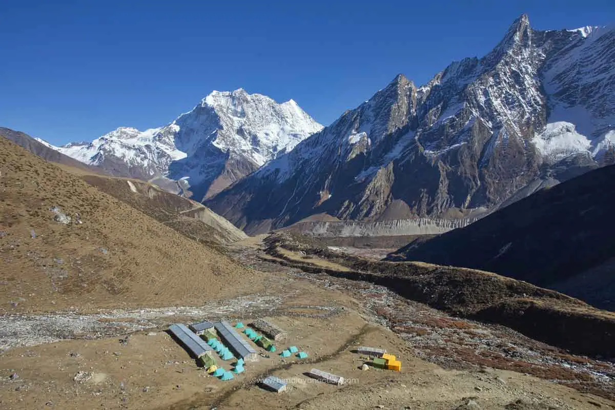
Trek ~3 hrs · 3 km. Short demanding uphill walk to the high-camp rest stop. Facilities are very basic: just a handful of simple lodges. Early to bed for the pass crossing tomorrow.
Trek ~10 hrs · 18 km. The biggest day. Pre-dawn 3 am start over steep, icy, snow-covered terrain to Larkya La Pass. At the top: panoramic views of Manaslu, Himlung Himal (7,126 m), Kang Guru (6,981 m), and Annapurna II (7,937 m). After the pass, a breathtaking glacial cirque reveals itself: a wall of peaks casting streams of glaciers. Long descent to Bimthang.
Trek ~7 hrs · 21 km. Final full trekking day. Long descent through lush rhododendron and oak forests, past historic glacial flood effects, through Gurung villages and terraced farmland, rejoining the lower Annapurna Circuit valley.
Drive ~7–12 hrs · 243 km. Jeep from Dharapani to Besisahar, then bus or jeep onward to Kathmandu. A long day of transition from the mountains back to the city.
Transfer to Tribhuvan International Airport for your onward flight. The trail stays with you long after the mountains fade from the aircraft window.
Get a detailed itinerary, permit guidance, and a personalised cost estimate. We'll walk you through every step of preparation.